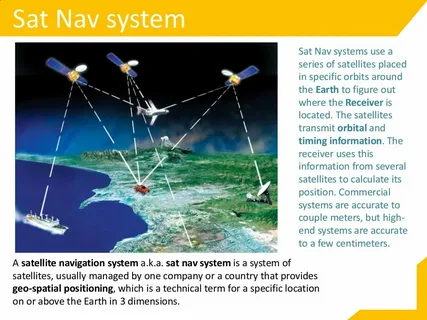
Global Navigation Satellite Systems (GNSS) have become an essential part of modern life, enabling navigation, fleet management, and location-based services. However, despite their widespread adoption, GNSS system face significant limitations, particularly in densely populated urban areas. Understanding the challenges in urban environments for GNSS systems is crucial for improving positioning accuracy and reliability.
1. Signal Blockage and Multipath Effects
One of the primary challenges in urban environments for GNSS systems is signal obstruction. Tall buildings, bridges, and other infrastructure can block satellite signals, leading to weak or intermittent connections. Additionally, urban surfaces such as glass, metal, and concrete can reflect signals, causing multipath errors. Multipath occurs when GNSS signals reach the receiver via multiple paths, leading to inaccurate positioning data.
2. Interference and Jamming
Urban areas often have high levels of electromagnetic interference due to cellular networks, Wi-Fi hotspots, and other electronic devices. This interference can degrade GNSS signal quality, making it difficult for receivers to maintain a stable connection. In some cases, deliberate or accidental jamming can further exacerbate the problem, highlighting the need for robust and interference-resistant GNSS technologies.
3. Limitations of Current GNSS Technology in Cities
Standard GNSS receivers are optimized for open-sky conditions and perform poorly in urban canyons. High-rise buildings can reduce satellite visibility, resulting in fewer satellites being available for accurate positioning. This limitation often leads to increased positioning errors, affecting applications such as autonomous vehicles, ride-hailing services, and urban logistics.
4. Mitigation Strategies
To address these challenges in urban environments for GNSS systems, several approaches have been developed:
- Multi-constellation GNSS receivers: Using signals from multiple satellite constellations (GPS, GLONASS, Galileo, BeiDou) increases the number of visible satellites in urban areas.
- Integration with other sensors: Combining GNSS data with inertial navigation systems (INS), LiDAR, or camera-based positioning can improve accuracy.
- Advanced signal processing: Techniques like multipath mitigation and error modeling can reduce positioning errors caused by urban obstacles.
Conclusion
The challenges in urban environments for GNSS systems are significant but not insurmountable. By understanding the sources of signal degradation and adopting complementary technologies, it is possible to enhance GNSS performance in cities. Continued research and innovation are essential to ensure reliable and precise navigation in the increasingly complex urban landscape.

