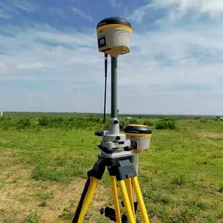
In recent years, the demand for high-accuracy geolocation in industries such as agriculture, construction, surveying, and autonomous navigation has surged. One of the most powerful technologies driving this revolution is RTK GPS (Real-Time Kinematic GPS). But what exactly is rtk gps, and how does it impact precision mapping?
What is RTK GPS?
RTK GPS is an advanced satellite navigation technique that enhances the precision of standard GPS signals. While traditional GPS receivers typically have an accuracy of 1–5 meters, RTK GPS reduces this margin of error to just a few centimeters. This is achieved by using a base station and a mobile receiver (rover), both of which process satellite data in real-time.
The base station is positioned at a known, fixed location. It calculates the difference between its known position and the position calculated from satellite signals, then transmits correction data to the rover. The rover uses these corrections to calculate its precise position in real time.
How RTK GPS Enhances Precision Mapping
1. Centimeter-Level Accuracy
In applications such as topographic surveying, drone mapping, and machine control in agriculture or construction, accuracy is everything. RTK GPS enables centimeter-level accuracy, allowing for extremely detailed and reliable maps to be created in real time.
2. Reduced Post-Processing
Before RTK GPS, mapping professionals often relied on data post-processing to achieve acceptable accuracy. With RTK GPS, real-time correction significantly reduces or even eliminates the need for post-processing, saving time and labor costs.
3. Consistency Over Time
Thanks to its real-time capabilities, RTK GPS provides consistent positional accuracy over repeated surveys. This is crucial in applications such as precision farming, where machinery must follow the same paths season after season without deviation.
Applications Across Industries
Agriculture
Farmers use RTK GPS for precision planting, spraying, and harvesting. The ability to navigate tractors within a few centimeters of previous passes minimizes waste and increases crop yields.
Construction and Surveying
RTK GPS allows construction crews and surveyors to stake out sites and monitor elevation changes with extreme precision, ensuring structural accuracy and compliance with design specifications.
UAV and Drone Mapping
Drones equipped with RTK GPS modules can produce high-resolution, geo-tagged imagery in real time, ideal for terrain modeling, land development, and infrastructure inspection.
Challenges and Considerations
Despite its many benefits, RTK GPS does have limitations. It requires a clear line of sight to satellites, and signal interruptions from trees, buildings, or other obstructions can affect accuracy. Additionally, the system depends on the availability of a stable base station or access to a network of correction signals.
The Future of RTK GPS and Mapping
As satellite constellations improve and RTK networks expand globally, the reliability and availability of RTK GPS will only continue to grow. Innovations like network RTK and integration with 5G are already paving the way for even more accessible and robust precision mapping solutions.
Conclusion
Understanding RTK GPS: How Real-Time Kinematics Revolutionize Precision Mapping is essential for professionals looking to harness cutting-edge geolocation tools. From agriculture to urban planning, RTK GPS is enabling a new era of accuracy and efficiency in mapping. As the technology evolves, its transformative impact on precision mapping will only become more significant.

